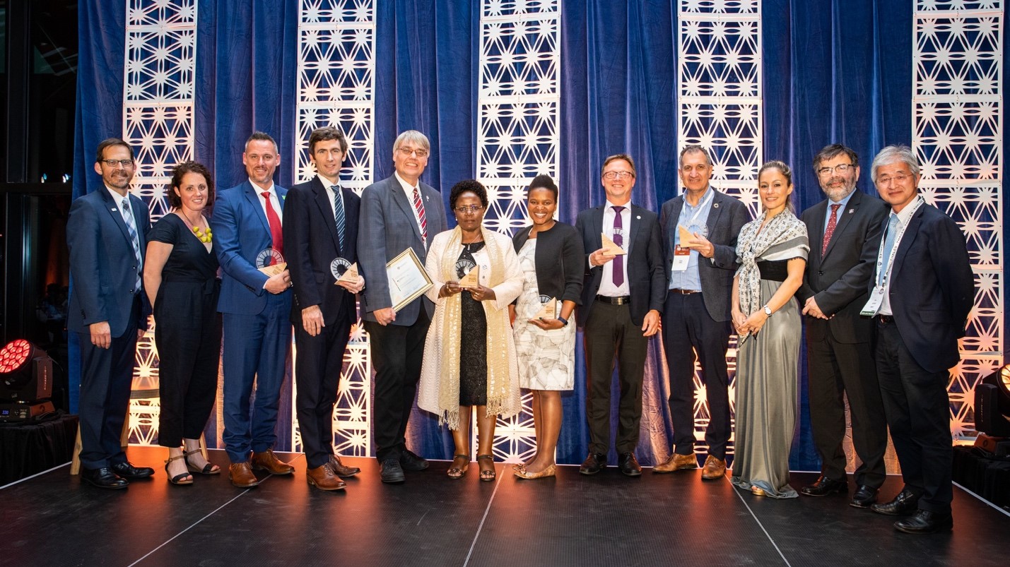
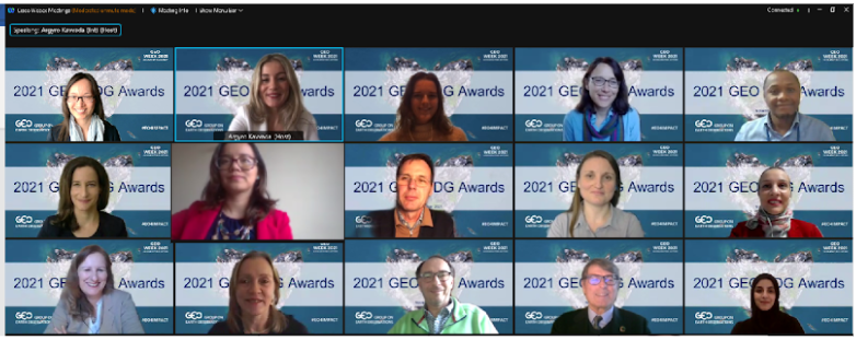
Announcing the 2021 GEO SDG Awards Winners
Launched in 2019, the GEO SDG Awards, led by the EO4SDG initiative, recognize institutions, organizations, and countries that are applying Earth observations towards the achievement of the Sustainable Development Goals. We are pleased to announce the winners of the third annual GEO SDG Awards. This year, we received 24 nominations from countries and organizations from around the world. Leading up to the announcement ceremony, nine panelists from across sectors and countries reviewed the nominations, assessing the overall impact, quality and soundness of the Earth observation endeavors, and gauging their potential to be replicated and scaled up.
We are thrilled to recognize eight organizations and countries for their exemplary work in Sectoral and Special Categories. In addition, one remarkable nomination is highlighted for a Special Mention.
SECTORAL CATEGORY AWARDS
GEO Member Country: Colombia
GEO Member Country: United Arab Emirates
Intergovernmental: United Nations Development Programme Colombia, Ecuador, Peru
SDG Custodian Agency: Food and Agriculture Organization of the United Nations
Academia: Stanford University
SPECIAL CATEGORY AWARDS
Innovation: The Netherlands Space Office
Testimonial/Story: Water@Reading Research Group, University of Reading
Collaboration: UN-Habitat, NASA, ITC, University of Twente, UAE Federal Competitiveness and Statistics Centre
SPECIAL MENTION
Inspiring Hope for Youth: International School of Milan / Viola Mascarucci
GEO Member Country: Colombia
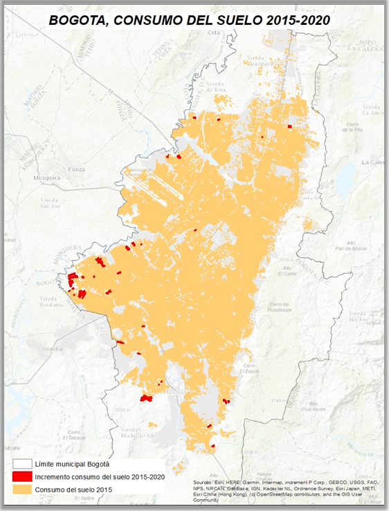
Colombia’s National Administrative Department of Statistics (DANE) has been successful at showcasing the value of statistical and Earth observation data integration to produce Sustainable Development Goal (SDG) indicators for national monitoring and decision making. Earth observations are an essential source of information for the exploration and calculation of SDG 11-related targets (sustainable cities and communities) for Colombia. Between 2015-2020, DANE used Landsat and Sentinel-2 satellite images, as well as census data and population projections to calculate SDG indicator 11.3.1 (ratio of land consumption rate to population growth rate) for 63 Colombian cities. Based on this experience, Colombia then developed a methodology to calculate SDG indicator 11.7.1 in a sample of nine cities in 2021, which had a substantial component associated with the classification of satellite images.
GEO Member Country: United Arab Emirates
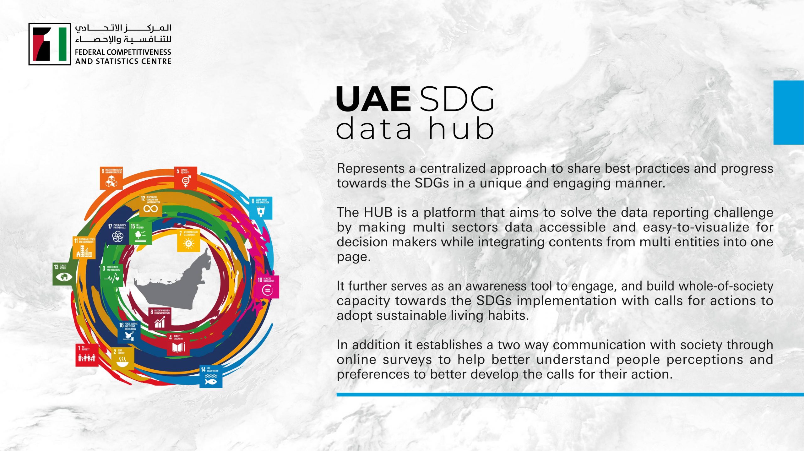
The United Arab Emirates’ (UAE) Federal Competitiveness and Statistics Centre created the SDG Data Hub (the HUB), a centralized approach to sharing best practices and progress towards the SDGs in a geospatially-enabled manner. The HUB is a geospatial platform that tracks and reports progress towards SDG implementation to the UAE Cabinet as well as to the United Nations Department of Economic and Social Affairs through the integration with the UN Federated Information System for SDGs. On the backend, it leverages geospatial intelligence in indicators compilation. It integrates data and content from multiple sectors and entities into one webpage making it accessible and easy to visualize in an efficient manner while utilizing web-based GIS principles. It further serves as a tool to engage and build societal capacity towards SDG implementation with calls for actions to adopt sustainable living habits. In addition, the HUB establishes a two-way communication with users through online surveys to understand people’s perceptions and preferences in order to better engage them. Select examples of how Earth observations/geospatial data can help advance the SDGs can be found in the HUB:
– UAE Urban Growth Through Night Lights and Satellite Imagery
– UAE National Red List for Mammals
– Rehabilitation of Coastal and Marine Habitat
Inter-governmental: UNDP Colombia, UNDP Ecuador, UNDP Peru
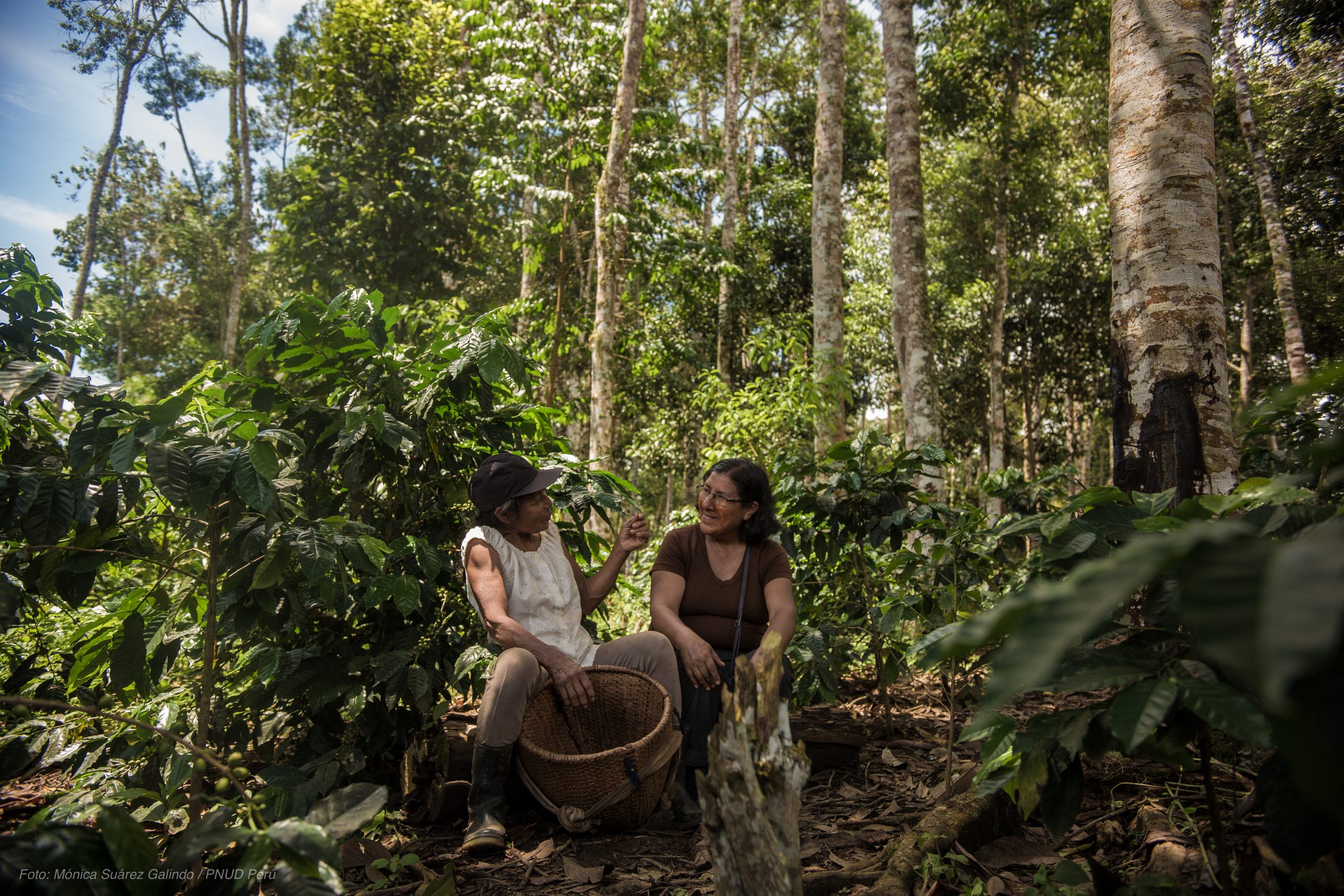
Colombia, Ecuador, and Peru are home to 17% of the world’s last tropical forests with high ecological quality. These high integrity forests provide a suite of services including carbon sequestration, habitat for iconic vertebrate species, and water filtration that are essential for planetary health and human well-being. However, current monitoring and reporting for SDG 15 (Life on Land) focuses primarily on forest extent, not forest quality. Spatial data and indicators offer a powerful means to help nations prioritize action, monitor results, and hold actors across sectors accountable. This project brings together UNDP, NASA, Montana State University, University of Northern British Columbia, University of Northern Arizona, and University of Queensland with scientists and policymakers from 37 institutions in Colombia, Ecuador, and Peru to address this gap. It aims to better understand national needs related to SDG 15, develop and nationally validate data and indicators on forest integrity, human pressure, water risk, and vertebrate species using Earth observations to analyze trends over time; forecast changes to 2,100 under various land use and climate change scenarios to inform SDG 15 planning and implementation; and make data indicators available to the UN Biodiversity Lab decision support system. The data and indicators developed by the project can support monitoring for the quality of tropical forest ecosystems and the services they provide around the world. To learn more, visit the “SDG 15: Maintaining Life on Land” story maps (English) | (Spanish).
SDG Custodian Agency: Food and Agriculture Organization of the United Nations
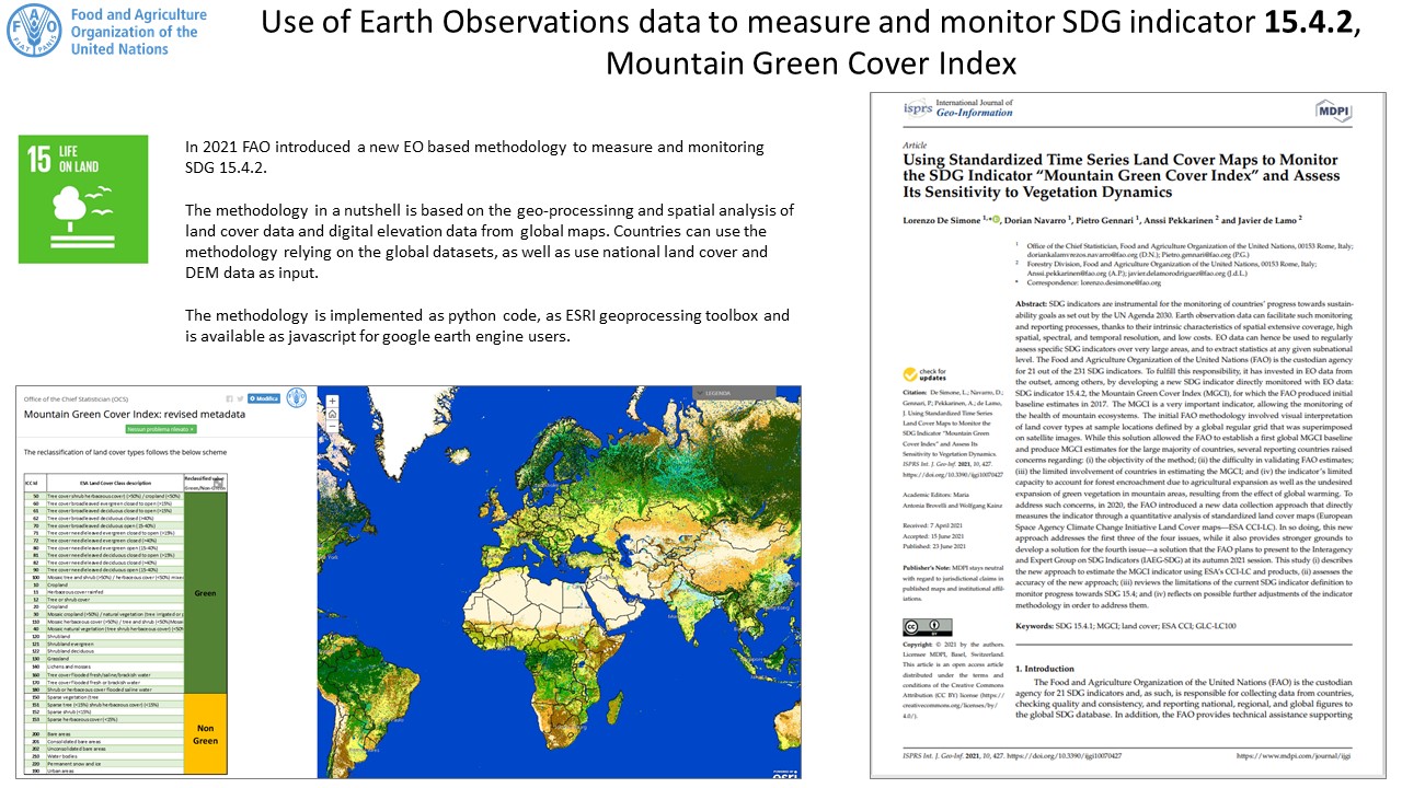
The Food and Agriculture Organization of the United Nations (FAO) developed a new method to measure and monitor SDG indicator 15.4.2 (Mountain Green Cover Index, MGCI) leveraging free and open Earth observation data sets from land cover time series, ground truth land cover, and mountain elevation range. By integrating Earth observation data into the official methodology, the FAO achieved a series of important results including the standardization of input and methodology that has allowed for internationally comparable results. The use of validated input layers, in turn, has allowed for accuracy measures associated with the MGCI estimates, leading to increased transparency. The MGCI computation is based on a quantitative model of spectral and textural characteristics of satellite time series data. This ensures objectivity of the MGCI estimation, as opposed to the subjectivity of visual interpretation that was used for the previous reporting cycle. Countries that have national land cover maps and digital elevation models with higher accuracy compared to global products can use this as inputs into the new FAO methodology. The FAO has supported countries in the validation of the MGCI estimates for 2021 by sharing their estimates with countries and asking to validate them using a WebGIS App, which facilitates the assessment of green vegetation cover in mountain areas.
Academia: Stanford University
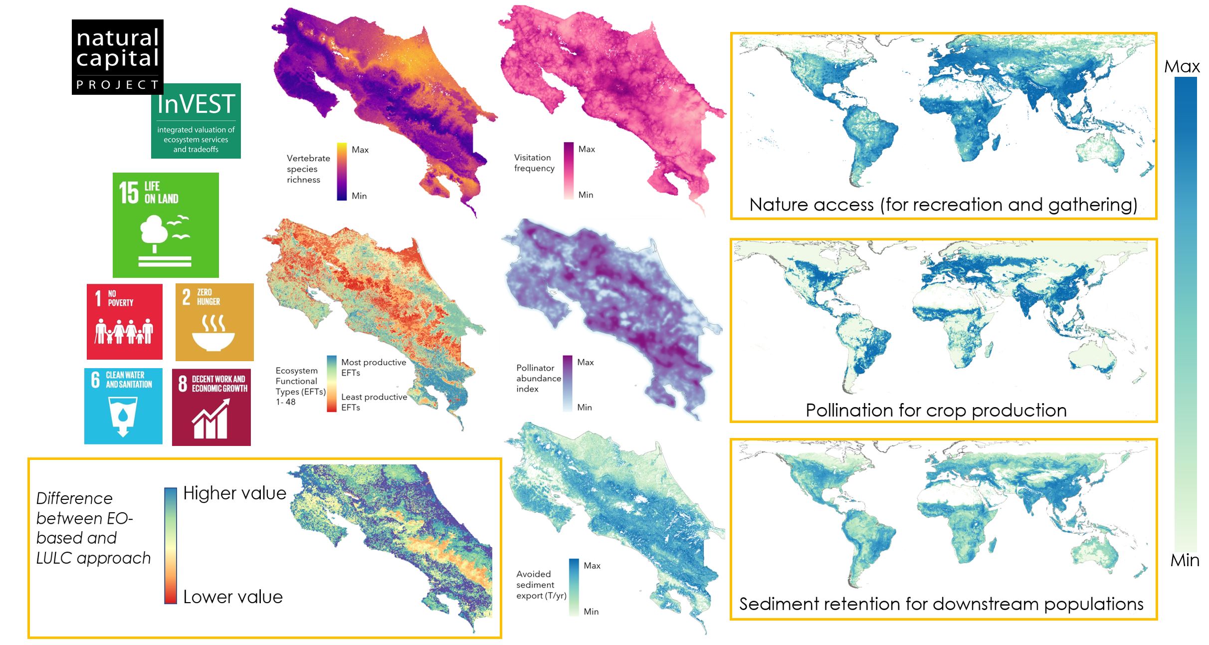
Nature supports us in myriad ways, many of them invisible. Society makes decisions on a daily basis that impact nature, and if those decisions are made without accounting for the values of nature to people, we risk losing many of those values. Stanford University’s work with Costa Rica’s Ministry of Environment, Energy and Telecommunications (MINAE), Central Bank and PRIAS Lab has aimed to make information about the values of nature more accessible, relevant, and accurate by advancing the integration of Earth observations into biodiversity and ecosystem service modeling. The project has produced national maps of 30+ data products hosted on MINAE’s SINIA data portal, including vertebrate and pollinator diversity as well as ecosystem functional diversity (SDG 15), which drive ecosystem services like wildlife-based tourism, crop pollination, and sediment retention (contributing to SDGs 1, 2, 6, and 8). These advances are being integrated into their free and open-source software, InVEST, and helping improve their global modeling, making these approaches more accessible to anyone anywhere in the world.
Innovation: The Netherlands Space Office
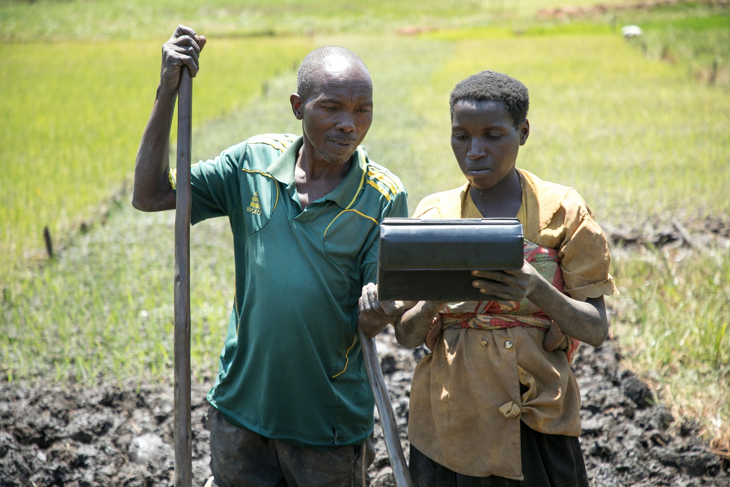
The Netherlands Space Office’s work on the Geodata for Agriculture and Water (G4AW) programme supports private investments for large-scale, demand-driven, and satellite-based information services targeted at vulnerable actors in food production. The agency has facilitated 25 public-private partnerships in 15 developing countries. Innovative solutions based on Earth observations provide actionable advice and financial services to smallholder farmers and (agro)-pastoralists. Organizations with different backgrounds work together to achieve SDG 2 (Zero Hunger). NGOs and extension officers play an essential role in engaging with food producers for gathering their information needs, building trust, and providing training. Entrepreneurs focus on customer satisfaction, affordability, business planning, and service provision. Examples of services include: weather information and forecasts, good agricultural practices, crop calendars, crop management (crop monitoring, pest- and disease warning, and nutrient advice), insurance, inclusive finance, and navigation services for (agro)-pastoralists. Geodata-based services are often bundled with market information, health information (ref. COVID-19), and training videos. Insights and lessons learned are shared via the agency’s website to inform and inspire other stakeholders to take action and invest.
Testimonial/Story: Water@Reading Research Group, University of Reading
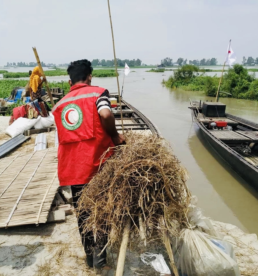
The Water@Reading research group uses state-of-the-art, global-scale forecasting models for humanitarian organizations to take early action ahead of flood events, in alignment with SDG target 13.1 that aims to strengthen resilience and adaptive capacity to climate-related hazards and disasters. The group nurtures partnerships between national hydrometeorological services (NHMS), humanitarian organizations, and global forecasting centres like the European Centre for Medium-Range Weather Forecasts. This enables the NHMS to inform the scientific development of global flood forecasting systems, and supports these state-of-the-art systems to reach their full potential as sustainable solutions embedded in national forecasting capacity. Through anticipatory humanitarian approaches developed in partnership with organizations like the Red Cross Red Crescent Climate Centre, these forecasts can support decisions which benefit the people most vulnerable to climate-related hazards before they strike. As an example of how Earth observations had an impact on the Government of Bangladesh, PhD researcher Sazzad Hossain joined the group from the Flood Forecasting and Warning Centre (FFWC) in Bangladesh. His research addresses how the Copernicus Emergency Management Service’s Global Flood Awareness System (GloFAS) can be used to inform FFWC and humanitarian operations to support communities in Bangladesh before an imminent flood. In 2020, over $5 million of humanitarian aid reached 200,000 people in advance of the highest water level ever recorded, based on the combined GloFAS and the FFWC forecast trigger.
Collaboration: UN-Habitat, NASA, ITC, University of Twente, UAE Federal Competitiveness and Statistics Centre
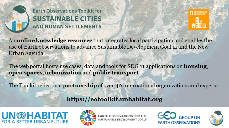
The Earth Observations Toolkit for Sustainable Cities and Human Settlements is an online resource that can assist countries and cities interested in applying Earth observations to advance their SDG 11 monitoring needs. Launched in February 2020, the Toolkit allows users to access ready-to-use data and develop indicators by combining data and tools found in the Toolkit with local data and knowledge. In addition, there is technical documentation and an array of use cases that can help support cities and countries with the implementation of SDG 11. Users can also contact Earth observation experts around the world if they want more one-on-one advice. The success achieved to date can be attributed to diverse partnerships, consistent communication, openness and transparency, continuous innovation, and clear added value of the resources available through the Toolkit. To enhance the replicability and usefulness for future Earth observation SDG Toolkits, four elements are essential: (1) a good understanding of the diverse data needs of users (especially non-Earth observation experts); (2) capacity development; (3) data review and documentation based on FAIR data principles; (4) purposeful and impactful data. Also needed is a clear implementation path and a strategy for partner and stakeholder coordination. For an overview of the Toolkit, please see the EO Toolkit for Sustainable Cities & Human Settlements story map.
“Inspiring Hope for Youth” Special Mention: Viola Mascarucci, International School of Milan
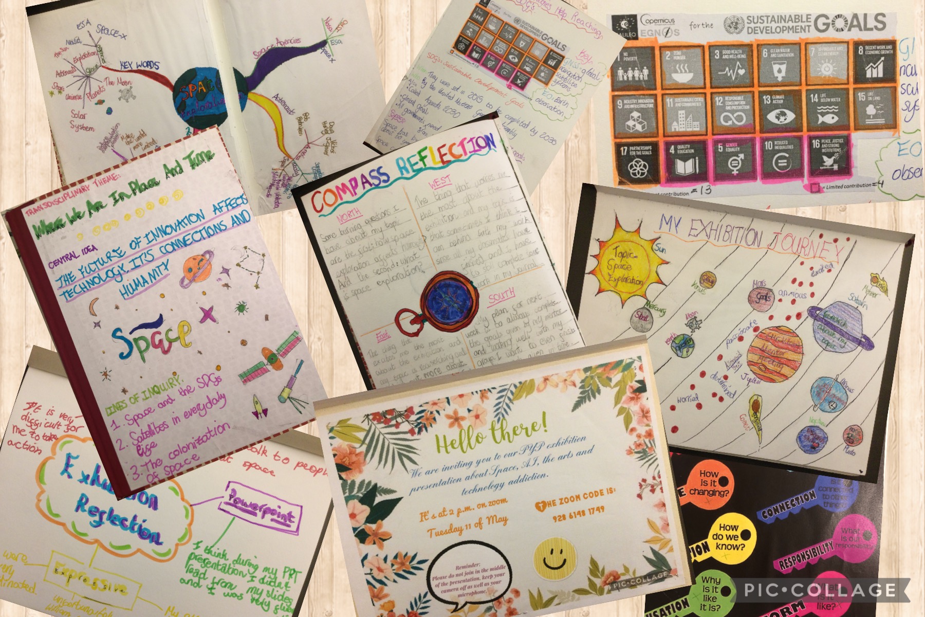
The International Baccalaureate Primary Years Programme Exhibition encourages students to learn to appreciate knowledge, conceptual understandings, skills and personal attributes as a connected whole. It culminates in an Exhibition, which takes place in year six where primary school students explore, document and share their understanding of an issue or opportunity of personal significance. For Viola Mascarucci’s (age 11, grade 7) Primary Years Programme Exhibition, she chose to explore how space innovation can help achieve several of the SDGs, highlighting in particular how Earth observations can benefit SDG #2 (Zero Hunger) and SDG #8 (Decent Work and Economic Growth). Viola researched the theme of how the future of innovation affects technology and how this connects to our everyday life and humanity. Her main lines of inquiry were: 1) space and SDGs, and; 2) satellites in everyday life. In addition, she conducted a number of interviews with highly-qualified female scientists and engineers working at the National Aeronautics and Space Administration and at the European Space Agency to learn about Earth observations applications, SDGs goals and targets, and how space agencies use space data to help achieve the UN 2030 Agenda on Sustainable Development. What was the most interesting thing Viola learned during her research? Watch her talk about it in this video.