Announcing the 2023 GEO SDG Award Winners
It is that time of year again when we are honored to announce our winners of the annual GEO SDG Awards! Launched in 2019, the GEO SDG Awards, led by the EO4SDG initiative, recognize institutions, organizations, and countries that are applying Earth observations towards the achievement of the Sustainable Development Goals. For the 5th annual GEO SDG Awards, each nomination was carefully reviewed by eight unique panelists representing various countries and sectors. Submissions were reviewed for overall impact, quality, and soundness of the Earth observation endeavors, and their potential to be replicated and scaled up. We congratulate each of our Sectoral and Special Category winners for their exemplary work!
SECTORAL AWARDS
GEO Participating Organization: Committee on Earth Observation Satellites (CEOS) SDG Coordination Group
SDG Custodian Agency: Food and Agriculture Organization of the UN (FAO)
Civil Society: World Resources Institute (WRI)
SPECIAL AWARDS
Statistical-Geospatial Integration: Bureau of Statistics Lesotho and FAO Lesotho
Innovation: Politeknik Statistika STIS
GEO Participating Organization: Committee on Earth Observation Satellites (CEOS) SDG Coordination Group
The Committee on Earth Observation Satellites (CEOS) ensures international coordination of civil space-based Earth observation programs and promotes exchange of data to optimize societal benefit and inform decision making for securing a prosperous and sustainable future for humankind. Satellite Earth observations enable a unique view of our world and generate substantial amounts of data that facilitate new methods and provide new insights to quantify, monitor and assess Sustainable Development Goals and related Indicators.
Since 2016, CEOS has actively supported GEO with coordinating sustained efforts across Space Agencies to promote and facilitate easier data uptake for countries in support of the UNSDGs. The SDG Coordination Group (formerly known as ‘ad hoc team on SDG’, SDG AHT) serves as the focal point on all SDG-related activities, to provide satellite Earth observation expertise to external partners including GEO, and highlight the invaluable contribution of satellite-based monitoring to keep track and achieve SDGs. For instance, in collaboration with global SDG experts and Custodian Agencies, CEOS has produced a dedicated “EO Handbook on SDGs” (2018), and more recently has produced a series of invaluable resources for Indicator reporting, providing information on satellite data availability for specific Indicators, opportunities and methods, observation gaps and needs. In addition to this, CEOS helps to set global standards for EO use on SDG analytics, which is critical to improve SDG measurement consistency and validation across the globe.
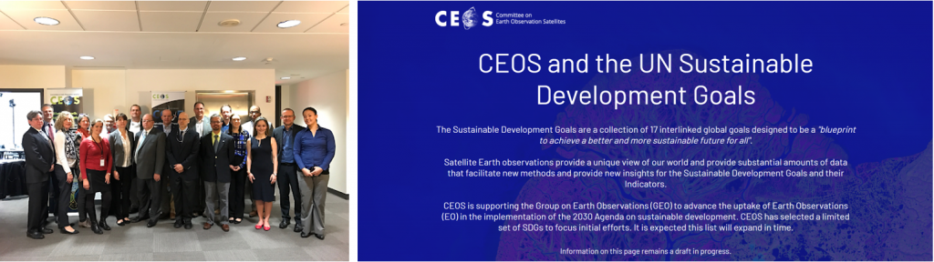
The CEOS SDG ad-hoc team in 2017 (left) and CEOS SDG feature website (right)
SDG Custodian Agency: Food and Agriculture Organization of the UN (FAO)
Monitoring land and water productivity by Remote Sensing, FAO WaPOR
FAO’s WaPOR portal provides access to remotely sensed derived data, and monitors and reports on agriculture water productivity in near-real time from 2009 onwards. Earlier editions covered Africa and MENA countries, and its global edition was launched on 4 October 2023, during the FAO Rome Water Dialogue. In addition to data production (in partnership with eLEAF) and dissemination, FAO actively supports the user groups in target countries in acquiring capacities for using the data and developing tailored applications that meet users’ requirements, in partnership with IHE Delft and IWMI.
The WaPOR data are several geographical datasets at multiple scales (ranging from 300 m to 20 m resolution) derived mainly from satellite observations concerning agricultural land productivity and water consumption (evapotranspiration). The core is information on ‘water productivity’: referring to the amount of agricultural yield produced per unit of water consumed (kg/m³). This is also referred to as ‘more crop per drop’ and is relevant for reporting of SDG 6.4.1 on water-use efficiency, for which FAO is custodian agency. All data, methodology, algorithms and scripts are openly available, and the data is also distributed through API to facilitate integration in existing platforms, tools, or applications.
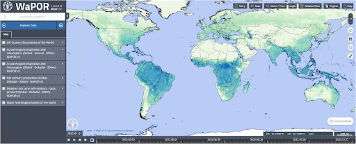
View of the WaPOR dashboard
Civil Society: World Resources Institute (WRI)
Energy Access Explorer
Energy services are highly interconnected with socio-economic development and human well-being. Yet, life without reliable energy is a reality for more than 675 million people globally. Effectively expanding energy access requires proper energy planning and access to transparent analytical tools and data. To help address this challenge, WRI, in collaboration with partners developed the Energy Access Explorer (EAE), a data-driven, integrated and inclusive approach to achieving universal access to energy for equitable, socio-economic development.
EAE is the first, open-source, online and interactive geospatial platform that enables energy planners, clean energy entrepreneurs, donors, and development institutions to identify high-priority areas for energy access interventions. EAE functions also as a dynamic information system, reducing software engineering and data transaction costs for both data providers and users and facilitating data management and governance. This endeavor fostered the creation of cross sectoral EAE working groups which enable an integrated and inclusive approach to energy planning. This platform’s achievements are visible through the use cases of Kenya, Zambia, Uganda, Nigeria, and Ethiopia.
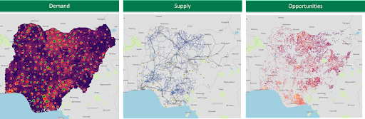
Market analysis of Nigeria for the Clean Energy Africa Minigrid program
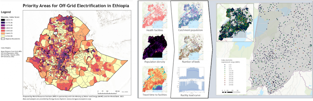
Map of off-grid electricity needs in Ethiopia (left) and available health-related datasets on the EAE platform (right)
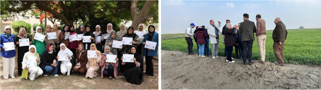
Statistical-Geospatial Integration: Lesotho Bureau of Statistics and FAO Lesotho
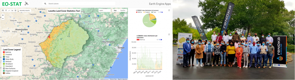
EOSTAT: EO for monitoring land cover, ecosystems, and reporting on SDG 15.4.2
The Bureau of Statistics of Lesotho and the FAO Office of Lesotho developed a solution that allows for on the fly computation of the mountain green cover index (MGCI) at the national level. EOSTAT is disaggregated by elevation zones, using 10m resolution Sentinel-2 land cover data. Prior to implementation, there were no mechanisms in place to update the existing national LC baseline from 2015, which made reporting on SDG 15.4.2 unattainable. In this context, this robust EO-based solution has been a game changer, as it satisfies a multitude of reporting tasks through national land cover and land cover change statistics. This allows for significant cost savings on field survey activities, and for pertinent data gaps to be filled with ensured accuracy, timeliness, and granularity.
Thanks to the big data infrastructure underpinning the solution, it was possible to integrate the Land Cover and SDG modules with specific ecosystem health indicators, simplifying the process to monitor ecosystem status in any area in the country at any time. EOSTAT is used by the National Meteorological Services to identify hotspots of vegetation degradation, monitor the impact of land restoration projects, and assess the impact of climate change on the status of ecosystems. The Ministry of Forestry, Range and Soil Conservation also uses the tool to monitor the health of rangelands in real time. This partnership with the national FAO office on the EOSTAT platform increased Lesotho’s national capacity to produce SDG indicators, and fostered new possibilities for monitoring national ecosystem health and ecosystem services.
Innovation: Politeknik Statistika STIS
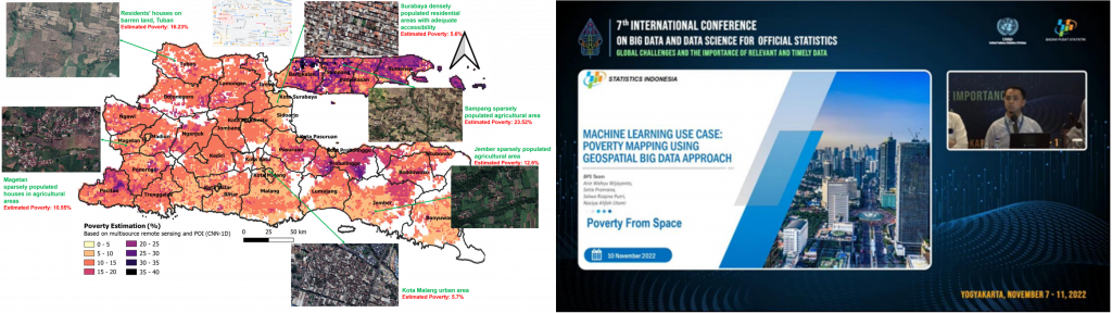
Granular Poverty Mapping from Space
Official poverty data have been usually collected through on-the-ground household-based socioeconomic surveys. Unfortunately, data collection with such conventional methods is expensive, laborious, and time-consuming. Additional information that can describe poverty with better granularity in scope and at lower cost, taking less time to update, is needed for more effective decision-making on poverty alleviation (SDG 1). Politeknik Statistika STIS, Indonesia has played a leading role in the study of leveraging Earth observation big data for poverty mapping, especially in Indonesia. Various geographical perspectives related to poor areas are obtained by analyzing multi-source satellite imagery and other geospatial big data. A machine learning-based model for estimating poverty is then constructed to provide estimates of poverty up to the 1 km grid level. This promising field is then expanded in terms of its application for granular child poverty mapping in order to support SDG target 1.2. To maximize its use in supporting poverty decision-making, the mapping results are presented in a 2D and 3D dashboard that is accessible to non-technical users. The 2D dashboard is designed to facilitate the identification of granular poor areas, while the 3D dashboard is focused on poor population distribution identification.
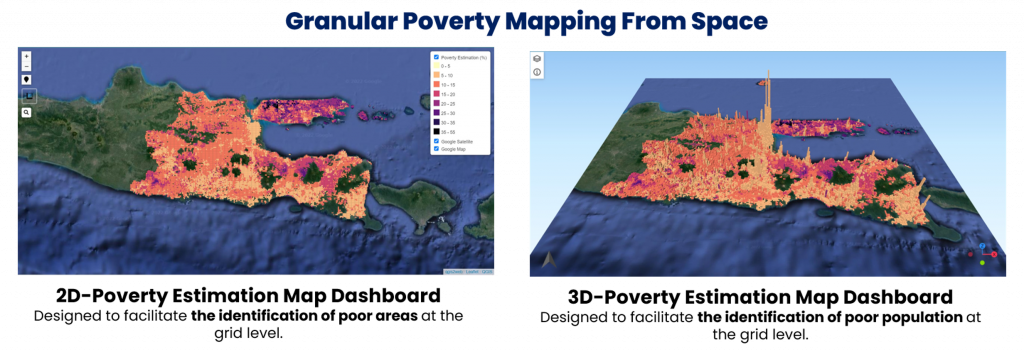
Granular Poverty Map Dashboard
Date Published: October 18, 2023


