Announcing the 2022 GEO SDG Awards Winners
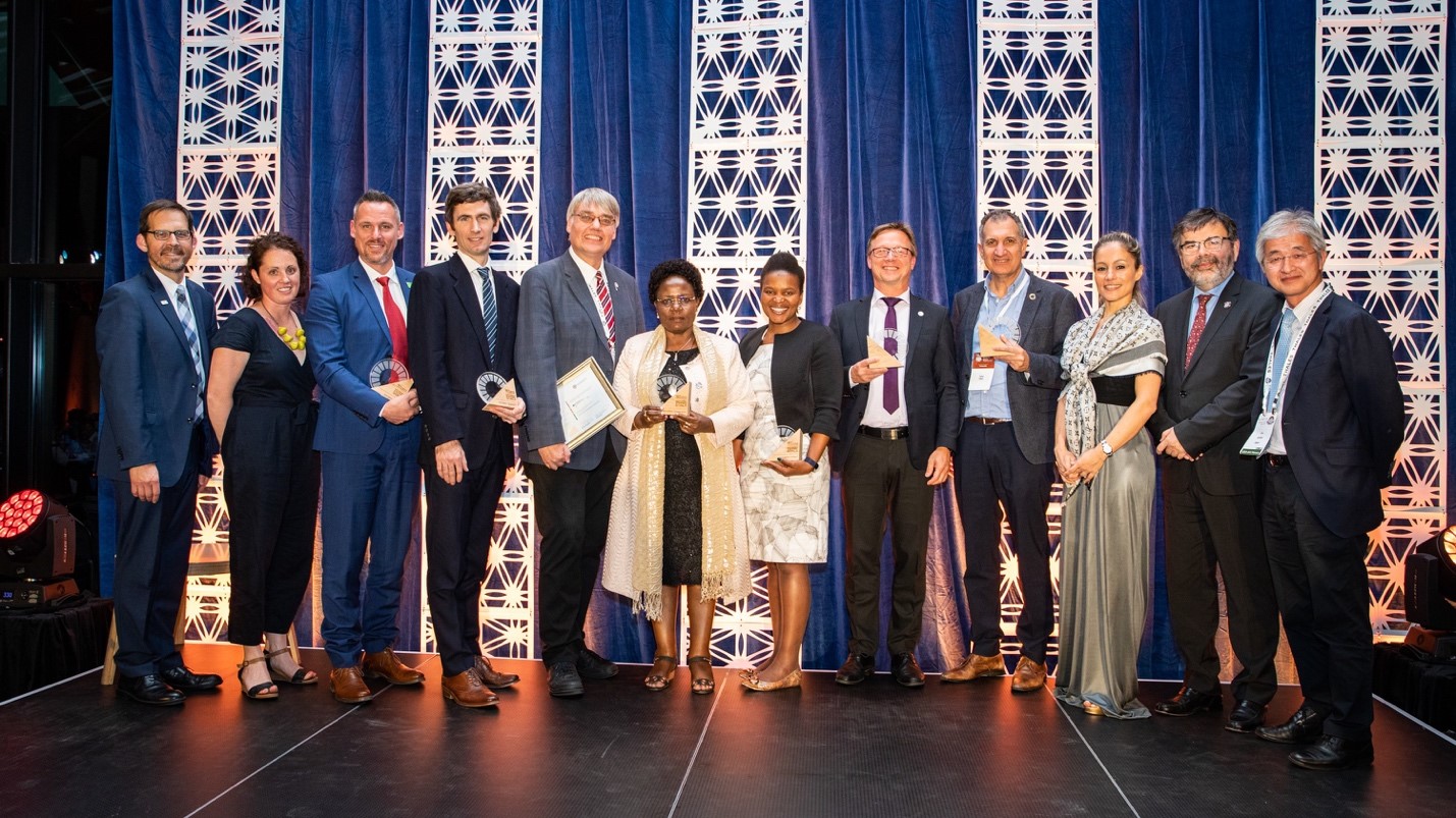
 Launched in 2019, the GEO SDG Awards, led by the EO4SDG initiative, recognize institutions, organizations, and countries that are applying Earth observations towards the achievement of the Sustainable Development Goals. We are pleased to announce the winners of the fourth annual GEO SDG Awards. This year, we received 20 nominations from countries and organizations from around the world. Leading up to the announcement ceremony, eight panelists from across sectors and countries reviewed the nominations, assessing the overall impact, quality and soundness of the Earth observation endeavors, and gauging their potential to be replicated and scaled up.
We are thrilled to recognize six organizations and countries for their exemplary work in the Sectoral and Special Categories.
SECTORAL CATEGORY AWARDS
GEO Member Country: Reforestamos México
GEO Participating Organization: United Nations Satellite Centre (UNOSAT) and United Nations Institute for Training and Research (UNITAR)
GEO Work Programme Activity: Digital Earth Africa
Academia: KTH Royal Institute of Technology
Commercial Sector: EOS Data Analytics
SPECIAL CATEGORY AWARDS
Collaboration: Costa Rica Ministry of Environment and Energy and the United Nations Development Program (UNDP)
GEO Member Country: Reforestamos México
Territorial analysis of 8 forest connectivity corridors in Mexico to determine potential restoration, conservation, and forest management activities to increase environmental services to the population
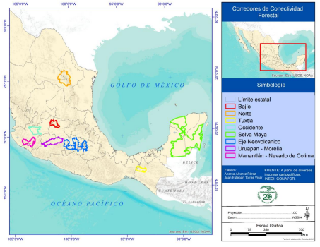
Reforestamos México has 20 years of experience in which it has implemented projects on conservation, restoration, and forest management issues to achieve its objectives of stopping deforestation, increasing sustainable forest management, restoring degraded lands, and planting trees in cities. Reforestamos generated updated spatial information across 8 forest connectivity corridors across 16 states of Mexico using Landsat 8 satellite images between 2019-2020 to generate Land Use and Land Cover (LULC) layers. The process consisted of identifying the potential areas of work using Geographic Information Systems, local site visits, coordination with the owners of the land, planning, financing, development, and monitoring. Reforestamos created updated layers of vegetation types and land use in areas that have high biological diversity and support ecosystem services across the states. These corridors add up to an area of 11,088,004.79 hectares, with a population of 18,791,448 inhabitants, and where there are 2,800 agrarian nuclei, or ejidos and indigenous communities. The outcomes of the project are supporting local decision makers regarding land management conservation, biodiversity, and ecosystem services (SDG 15.2, progress towards sustainable forest management). The project has enhanced local partnerships and built new alliances to support better local land management.
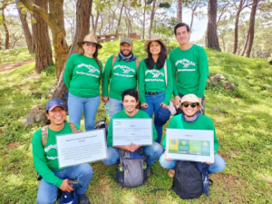
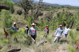
Caption: Community forestry brigade working on reforestation in Mexico and locally trained students.
GEO Participating Organization: United Nations Satellite Centre (UNOSAT) and United Nations Institute for Training and Research (UNITAR)
UNOSAT Emergency Mapping Service
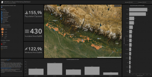
UNOSAT’s Emergency Mapping service provides satellite image analysis during humanitarian emergencies related to disasters, complex emergencies, and conflict situations. With a 24/7 year-round availability to process requests, the team of experienced analysts ensure timely and tailored delivery of satellite imagery derived maps and products, as well as GIS data for evidence-based decision making and operational planning. These outputs range from GIS ready data (e.g., flood extents and damage assessments), statistics, reports, and web applications. All these products are made available, free of charge, and can be downloaded on the UNOSAT website. The emergency mapping service activation sharing mechanism follows 5 simple steps, which include situation, users, activation, process, and product. In 2021, UNOSAT supported fellow UN agencies in Nepal to aid the country in better monitoring flooding during monsoon season. During one emergency activation request, UNOSAT deployed its FloodAI system to create a dashboard that visualized the number of people potentially affected by the floods (SDG 11.5). In December 2021, a category 5 Tropical Cyclone struck the Philippines. Following a request from the Regional Office for Asia and the Pacific in Bangkok, UNOSAT’s Emergency Mapping service was activated to support the planning and coordination of emergency response operations with satellite imagery analysis (SDG 13.1, 17.6).
GEO Work Programme Activity: Digital Earth Africa
How data and community can save Zanzibar’s mangroves
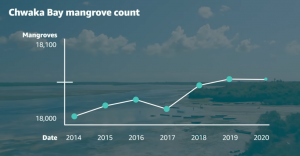
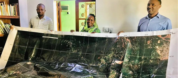
In Zanzibar, Tanzania, the local communities rely on mangroves to stabilize the shorelines, protect the land and people from natural disasters and to provide habitats for marine life. Sadly, these mangrove habitats are regressing at an alarming rate. Coastal erosion, rising sea levels and human activity have not only contributed to the degradation of mangroves on the Island, but have led to loss of suitable fish along the shoreline. UN Sustainable Development Goal 14.5 endeavors to conserve these important coastal and marine areas, and the Tanzanian government has been taking protective measures to help achieve this target. Researchers from the State University of Zanzibar (SUZA) are using Digital Earth Africa (DE Africa) to obtain insights into the trends of mangroves in Zanzibar and empower the community to make better informed decisions regarding the impacts of climate change. The researchers have empowered their students to use DE Africa to monitor and assess changes in mangroves and, in turn, collaborate with the Youth Mappers SUZA chapter to validate the results. Further, the local populations are now planting more mangroves through volunteer organisations such as Zanzibar Volunteers for Environmental Conservation. As a result of the project, the community is more prepared to make decisions regarding rising seas (SDG 13) and has engaged with the Office of Government Statistician to support climate action and complement data gaps leveraging the DE Africa partnership. Restoring mangrove forests also supports progress towards many other SDGs including eliminating poverty and hunger (SDG 1, 2), ensuring livelihoods and economic growth (SDG 8), taking actions against climate change impacts (SDG 13) and halting biodiversity loss (SDG 15).

Academia: KTH Royal Institute of Technology
The Google Earth Engine App for Interactive City Definition and Automatic SDG Indicator 11.3.1 Calculation
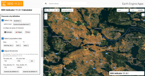
KTH Royal Institute of Technology in Stockholm, Sweden has played a leading role in leveraging Earth observation big data for urban mapping and urbanization monitoring to support sustainable and resilient urban development. KTH developed the Google Earth Engine App for Interactive City Definition and Automatic SDG Indicator 11.3.1 Calculation. The City Definition Tool can automatically or interactively generate city definitions based on the Degree of Urbanization, endorsed by the UN to make the performance of different cities comparable. The Degree of Urbanization is a method that relies on a population grid to classify local units into three classes: cities, towns & suburbs, and rural areas. The SDG 11.3.1 Calculator computes and visualizes the primary and secondary indicators of SDG indicator 11.3.1, Land Use Efficiency, following the global indicator methodology. The application was designed on a Google Earth Engine backend and is fully functional on a web browser without the need for additional installations. The app not only enables users to compare different population and EO-based built-up datasets directly within a web browser, but also offers users the possibility to input their own data and adjust boundaries of their city definition when needed. The app for city definition and SDG indicator 11.3.1 calculation is easy to use and can be utilized by any city in the world for their SDG 11.3.1 monitoring and reporting.
SDG11.3.1 App:
https://eo4sdg11.users.earthengine.app/view/sdg-1131-indicator
Comparison of Urban Data app:
https://eo4sdg11.users.earthengine.app/view/urban-comparison
Commercial Sector: EOS Data Analytics
AI-powered satellite imagery analytics: EOSDA Crop Monitoring, EOSDA Forest Monitoring, EOSDA LandViewer
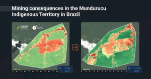
EOS Data Analytics (EOSDA) generates satellite-driven insights across 22+ industries and in support of 10 of the 17 Sustainable Development Goals. EOSDA is part of the Noosphere space group and partners with governmental, commercial, and scientific organizations. EOSDA primarily supports the agriculture industry via the EOSDA Crop Monitoring product, a digital precision agriculture tool that helps farmers remotely assess the health of their crops, cut costs on scouting, soil testing, farm management, and use seeds and fertilizers more efficiently, particularly important to SDG 2.4 and SDG 12.4 Additionally, EOSDA Forest Monitoring is an online satellite-based software for forestry management. Using satellite imagery, the software enables landowners, logging companies, and research institutes, among others, to remotely monitor forest health. The EOSDA LandViewer is an online GIS-assistant that provides a set of specific geospatial technologies to extract valuable information from big data to meet the needs of sustainable business practices. It provides on-the-fly searching, visualizing, and processing of data by applying more than 10 indices available on the platform. EOSDAs products support resilience and adaptive capacity to climate-related hazards and natural disasters for its users (SDG 13.1, Strengthen resilience and adaptive capacity to climate-related hazards and natural disasters in all countries).
Collaboration: Costa Rica Ministry of Environment and Energy and the United Nations Development Program (UNDP)
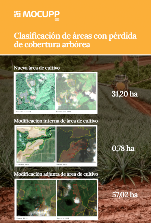
Monitoring of Land Use Change in Productive Landscapes (MOCUPP)
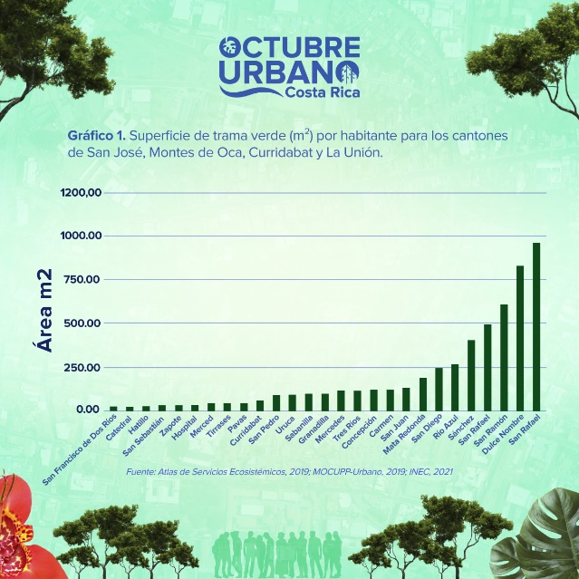
The Costa Rica Ministry of Environment and the United Nations Development Program developed the “Monitoring of Land Use Change in Productive Landscapes – MOCUPP” tool to support the sustainable management of key productive landscapes (SDG 2.3, 2.4, 12.2) where agricultural export crops are grown nationally, including pineapple, oil palm and cattle pasture, and also to monitor green cover (SDG 11) in the Maria Aguilar Urban Corridor, which crosses four municipalities in the Greater Metropolitan Area of Costa Rica. Annually, MOCUPP produces maps and reports of these coverages and related tree cover loss and gain, using digital identification techniques by processing satellite images and field data, with the contribution of public academic institutions. The geospatial information generated by MOCUPP is publicly available in Costa Rica’s Spatial Data Infrastructure and the reports are available on the project’s website. The MOCUPP generates data to be used in the environmental and productive sector demonstrates deforestation-free production practices. The data can be used in initiatives such as the Nationally Appropriate Mitigation Action strategy, as well as in different national regulations and international climate agreements and for any land management process focused on agricultural and environmental landscapes in the country. Costa Rica is developing MOCUPP under the leadership of the Ministry of Environment and Energy, through the National Center for Geoenvironmental Information, and the United Nations Development Program Office in Costa Rica, within the framework of the National System for Monitoring Land Use, Land Cover and Ecosystems – SIMOCUTE. In the coming years, the project is expected to increase the types of productive landscapes monitored by MOCUPP, including coffee and banana plantations.


