
Copernicus for SDG (Cop4SDGs)
The Agenda 2030 provides a framework to make life on our planet better and more sustainable for our future generations. It consists of 17 Sustainable Development Goals (SDGs), divided into 169 targets and approximately 232 indicators which relate to all realms of society and spheres of life, both on land and water. Much of social and economic sustainability lies in improving the quality of human life while preserving and efficiently using our natural resources such as forests and water. To assess whether the SDGs have actually been achieved or to observe how far the road to achieving them still is, a global set of indicators was developed. The indicators have been assigned to so-called Tier classes, where Tier I represents indicators with globally available data and methods and Tier III represents indicators for which both data and methods are missing.
For Germany, the Federal Statistical office is responsible for reporting the status of the SDGs and works together with other federal agencies and institutions to obtain data. The 232 indicators are mainly collected and reported based on demographic and statistical data or using data from models or surveys. More recently, the use of Earth observation (EO) data for monitoring and supporting the implementation of the SDGs, targets and indicators is being more frequently used and encouraged by the UN. EO datasets have the advantage that they are, to a large part, freely available, global and can enable more timely statistical outputs while providing a consistent means to report and measure the SDGs.
In 2018, the Cop4SDGs (Copernicus for SDGs) project was launched between the German Federal Office of Cartography and Geodesy (BKG) and the German Environment Agency (UBA) to aid the German government in developing procedures for monitoring the SDGs using EO datasets. The aim of the Cop4SDGs project is to examine the extent to which the SDGs can be verified and reported by means of Copernicus data or other EO datasets, in order to close data gaps in the national reporting process, in view of the German National Sustainable Development Strategy. Funded by the German Federal Ministry for Environment, Nature conservation and Nuclear Safety, Cop4SDGs also aims to develop methods for calculating the SDG indicators using Copernicus and EO data.
The Federal Statistical Office publishes a detailed indicator report every two years (latest being published in July 2018). Currently 114 indicators are reported. The rest are either not relevant to Germany or data to report these indicators are unavailable (27 Tier I, 41 at Tier II and 50 at Tier III indicators). The use of Copernicus data and products to calculate these indicators is presently being analyzed and will be reported within the Cop4SDGs project. National datasets developed on the basis of Copernicus or other EO data will be explored and practical implementation for the indicators that need to be reported will be tested. Implementation examples for Tier I indicators such as Indicators: 3.9.1 (mortality due to air quality), 6.4.2 (water stress), 6.6.1(water-related ecosystems), 13.1.1 (people affected by diseases), 15.3.1 (land degradation) and 15.4.2 (mountain green cover) will be analyzed. Methods and visual presentations such as story maps will then be developed to explain the reporting of these indicators and how EO data can assist in their monitoring.
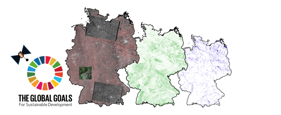
Earth observations & other data sources: Copernicus data from the Sentinel satellites, Copernicus products from the Copernicus services; Model data from the German Land cover model and Germany Terrain model.
Progress: The project is its first year where the use of Copernicus and EO data for the reporting and implementation of identified SDG indicators is being explored. In cases where Copernicus data or other EO data can be used for calculating the indicators, national maps will be produced. For Tier I indicators, the datasets suggested by the UN custodian agencies will be used, and when not available, Copernicus data or modelled data extracted from EO data will be used.
Challenges/ Key issues: One of the major challenges while calculating the national indicators is the implementation of the method described by the custodian agencies in the UN metadata repository. While Tier I indicators are expected to be calculated and reported using the same global dataset and a predefined methodology, data to calculate certain parts of the indicator (sub-indicators) may not be available at the global level (even though the indicator is given a Tier class I). This prevents the implementation and calculation of the SDG indicator based on the predefined method suggested by the UN and promotes the development of other methods, which may be country or region specific. This also promotes the use of national statistical datasets or other nationally available datasets which limits transferability of the methods implemented as other countries might not have comparable datasets, methods or tools to calculate these sub indicators.
Next Steps:
The use of Copernicus High Resolution Layer ‘water and wetness’, and the CORINE Land cover datasets are currently being analysed with respect to the Indicator 6.6.1. Other indicators such as indicator 3.9.1. and 6.4.2. will be analysed thereafter.
End Users:
- German Federal Ministry for Environment, Nature Conservation and Nuclear Safety
- Federal Statistical Office
- German Federal Government
- Group on Earth Observations (GEO)
- Earth Observations for Sustainable Development Goals (EO4SDG)
Partners/Contributors:
- German Federal Agency for Cartography and Geodesy
- German Environmental Agency
Figures and other material:
Acknowledgments: This article was authored by Dr. Gopika Suresh (BKG) and Dr. Christian Schweitzer (UBA).
View All Projects


