Connecting SDG 11 to Sustainable Urbanization
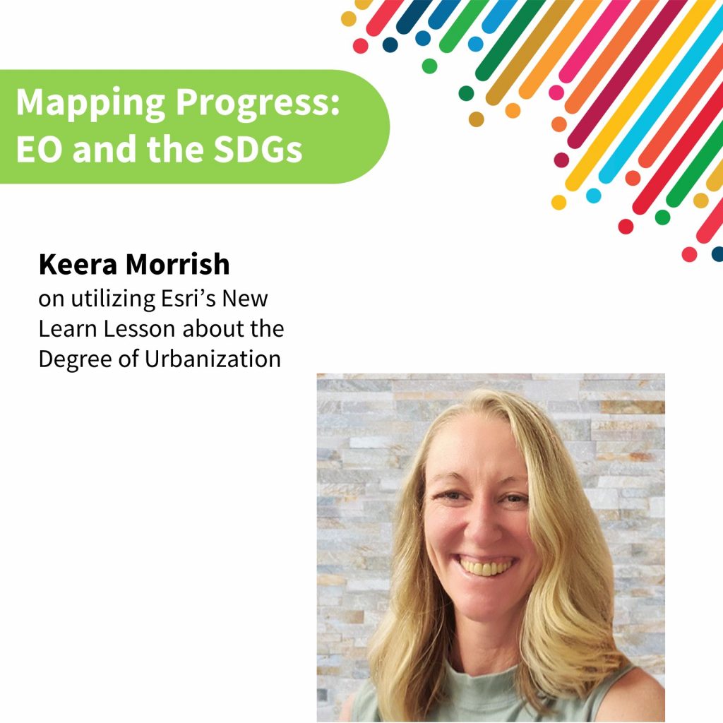 Keera Morrish is a Solutions Engineer for Non-Profit and Global Organizations at Esri and an Adjunct Professor at Georgetown University in Washington, DC. She works with many international clients such as the World Bank Group, USAID, and Inter-American Development Bank to address complex problems through the customization of comprehensive technical solutions.
Much of Keera’s role involves holding international client stakeholder meetings to develop specialized tools and monitor dashboard prototypes. This work not only impacts lives around the world but affects lives particularly in high-conflict, fragile, and very low-income states. Many of her completed projects demonstrate strengths in content creation spatial analysis, cross-functional collaboration, customer relationship-building, and creativity.
This article discusses the new ArcGIS Learn Lesson produced by Esri, that can be found HERE. The lesson deals with the Degree of Urbanization by applying a methodology to classify urban and rural areas that was endorsed by the United Nations Statistical Commission.
Information about Esri and Keera can be found at Keera’s LinkedIn, European Commission Officer Pietro Florio’s LinkedIn, several Esri handles including @Esri_Nonprofit, @EsriSLGov, @UNHABITAT, @EU_ScienceHub, and the Esri Sustainable World group.
This is the third entry in our new series “Mapping Progress: EO and the SDGs,” which highlights voices from the EO4SDG community and beyond.
Introduction and Background of the EO Toolkit
The EO Toolkit for Sustainable Cities and Human Settlements was launched in 2021 in collaboration with UN Habitat and 40 international organizations. It contains critical open-source data resources which enable users to utilize Earth observations to advance SDG 11 and UN Habitat’s New Urban Agenda. Esri, a company that develops geographic information system (GIS) software, is a contributor of the EO Toolkit. Esri has actively aligned its operations with the Sustainable Development Goal (SDG) 11’s core principles of equity, public safety, climate resilience, and sustainability in pursuit of this global objective. Esri’s GIS solutions are deployed in hundreds of thousands of organizations globally, including Fortune 500 companies, government agencies, nonprofit institutions, and universities. This geospatial technology helps leaders in all aspects of a community make data-driven decisions, advance sustainable, equitable urban planning, and more.
SDG 11 focuses on making cities and human settlements inclusive, safe, resilient, and sustainable. Practically, this alignment to SDG 11 means that Esri leverages its expertise and resources to create innovative solutions and tools. These solutions enable governments, businesses, and communities to better plan, manage, and improve urban areas. These solutions encompass a wide range of applications, from urban planning and disaster preparedness to environmental monitoring and infrastructure development.
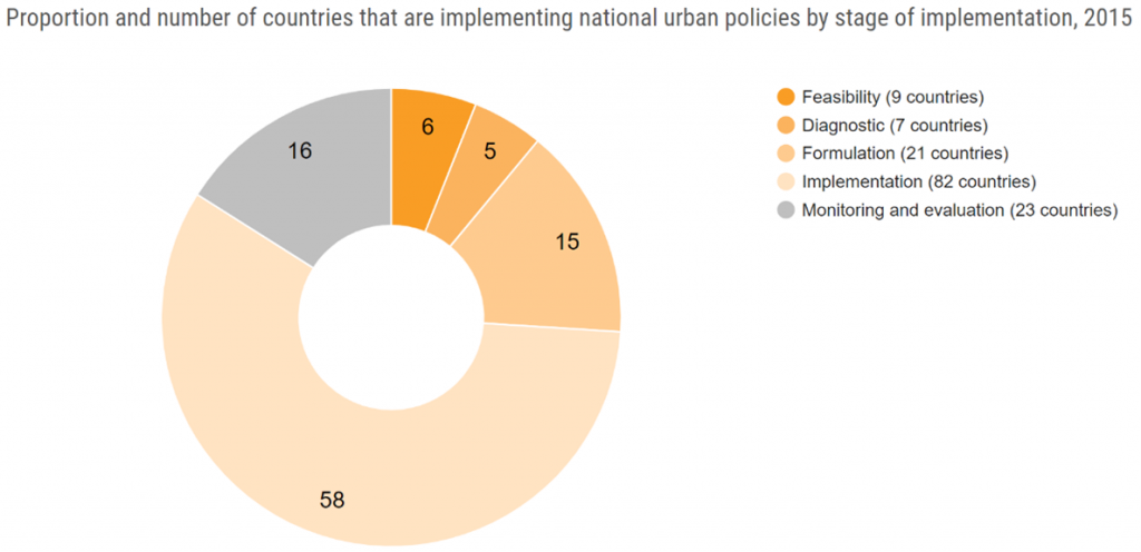
As part of their commitment to advancing SDG 11, Esri has recently introduced a new educational resource called “Classify areas by degree of urbanization,” available on Learn.ArcGIS.com. This lesson aims to empower individuals and organizations to understand and classify urban areas, which is essential for informed decision-making and sustainable development. Below is a graphic created by the United Nations (UN) Statistics Division regarding SDG 11. The graphic highlights the proportion and number of countries that began implementing national urban policies in 2015, when the UN’s 2030 Agenda to achieve the SDG Goals was created.
This lesson was made possible with the support and collaboration of EO4SDG, UN-Habitat, and the EU Joint Research Centre (JRC). By making these resources available, the partnership enabled an understanding of the Degree of Urbanization, or DEGURBA, methodology (discussed below), ensuring those aiming to contribute to SDG 11 have the necessary tools.
In the lesson, we emphasize the link between SDG 11, specifically Target 11.3.1, which focuses on the ratio of land consumption rate to population growth rate, and the 2022 UN Statistical Commission-endorsed Degree of Urbanization method. This method standardizes the classification of urban and rural areas worldwide and facilitates monitoring urbanization’s impact on various aspects, including access to amenities and challenges like air pollution and crime. Additionally, it plays a crucial role in tracking progress toward the UN’s SDGs, introduced in 2015, with a primary focus on poverty reduction and environmental protection.
The Significance of Degree of Urbanization
DEGURBA is more than just a classification system; it is an essential methodology endorsed by the UN Statistical Commission for categorizing territories based on human settlement types. DEGURBA provides a standardized approach to classify areas such as cities and villages, offering a harmonized method for comparing regions on an international and regional scale.
Understanding SDG 11
SDG 11—Sustainable Cities and Communities—serves as a beacon for creating urban environments that are not only inclusive and safe but also possess the resilience and sustainability necessary for the future. Key to achieving this goal is Target 11.3, which sets a clear objective to enhance inclusive and sustainable urbanization through participatory, integrated, and sustainable human settlement planning and management in all countries. Within this target, Indicator 11.3.1, the ratio of land consumption rate to population growth rate, plays a pivotal role in assessing progress toward sustainable urbanization.
The Learn Lesson: An educational resource
Having the necessary tools and knowledge to effectively measure and understand Indicator 11.3.1 is essential. The ‘Classify areas by degree of urbanization’ Learn Lesson is a resource designed to educate and equip individuals and organizations with the skills required to compute this indicator. This lesson contributes to the interactive learning path developed by the EO Toolkit for Sustainable Cities and Human Settlements team and uses the ArcGIS Toolbox to create internationally comparable boundaries needed to calculate SDG 11.3.1.
While vital for assessing urbanization progress, this indicator requires specific skills and knowledge in spatial analysis and data computation.
There are three modules in the lesson. Learners are guided through the following:
-
- creating population grids
- creating degree of urbanization grids
- classifying territorial units
A case study of New Caledonia is used in this lesson to teach students how to classify urban and rural areas around the world. By using standardized urbanization methods, officials can better monitor and report progress toward UN Sustainable Development Goals for a country or region.
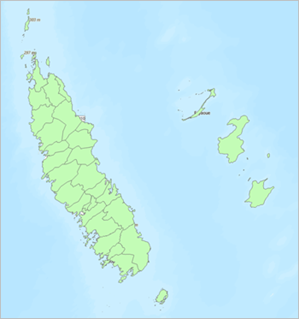
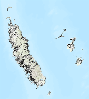
The image above on the right for example, is the layer that displays the 33 communes in New Caledonia. Communes can be used as a unit for determining urbanization as they are similar to the categorization of a township or municipality. The image on the left displays the result of masking the data so that values of 0 are transparent. Doing this produces a map that only shows locations where people live.
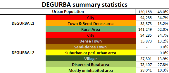
At the end of the tutorial, you will have learned to create a map with the degree of urbanization classification for each commune. In addition to creating a map displaying the degree of urbanization, you learn how to use ArcGIS to produce a spreadsheet, such as the one below that has the statistical break down of the total population and the percent of the population in each settlement class.
Conclusion
Education and access to resources are pivotal in achieving SDG 11 and ensuring the sustainable development of our cities and human settlements. The Learn Lesson bridges the gap between the principles of SDG 11, especially Indicator 11.3.1, and the practical skills required to measure and advance sustainable urbanization. As we harness the power of earth observations and geospatial knowledge and apply it to real-world challenges, we move closer to a future where our cities are inclusive, safe, resilient, sustainable, and well-equipped to adapt and thrive in an ever-changing world.
Date Published: November 08, 2023


