Learning how to apply satellite data to estimate total forest area and forest change:
A June 2017 NASA webinar enabled participants to learn how satellite data can be applied to address Sustainable Development Goals (SDGs) concerning forestation.
The webinar demonstrated how satellite observations can be used to calculate indicators for 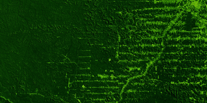 Sustainable Development Goal (SDG) 15, Protect, restore and promote sustainable use of terrestrial ecosystems, sustainably manage forests, combat desertification, and halt and reverse land degradation and halt biodiversity loss. Participants learned how to acquire satellite observations used to assess forest area as a proportion of total land area (indicator 15.1.1) and the proportion of land that is degraded over total land area (indicator 15.3.1). The webinar also included an overview of the SDGs, as well as an introduction to image classification and change detection. Additional information about this webinar, recordings of webinar sessions, and presentation slides can be accessed here.

View All Capacity Buildling


