NASA Lifelines: A Story of Resilience Planning and International Collaboration
 Reece Williams leads the Earth Science Review Board at NASA Lifelines and coordinates their communication across platforms. He is a consultant at DevGlobal, where he delivers solutions across agriculture, geospatial, and event management sectors. Alongside Lifelines, Reece has worked extensively with the Bill & Melinda Gates Foundation, providing strategic support for machine learning projects and enhancing their internal geospatial operations. To learn more about Lifelines, head to their LinkedIn , Instagram, and website.
The multidimensional nature of the global climate crisis demands collaboration – a bringing together of different experts, a wide range of communities, and people from around the globe. When looking at United Nations Sustainable Development Goal 13 (Climate Action), this need for unity and collective action is extremely relevant. With targets focused on strengthening climate resilience and taking action to both limit and adapt to climate change, there is a strong need for external support in facilitating this connection. NASA Lifelines is an organization that is dedicated to promoting this interdisciplinary collaboration and uniting humanitarian and scientific communities.
Through our work, we’re pushing forward the urgent action necessary to combat climate change and mitigate its impacts on vulnerable populations. The rich community of practitioners at this intersection are ensuring that Earth observation technologies are used to improve decision-making and save lives.
Bringing New Expertise to Real-World Humanitarian Initiatives
One of the collaboration-driven initiatives within NASA Lifelines is the Earth Science Review Board. The Earth Science Review Board brings together individuals from different disciplines—people who would not typically collaborate in a professional setting.
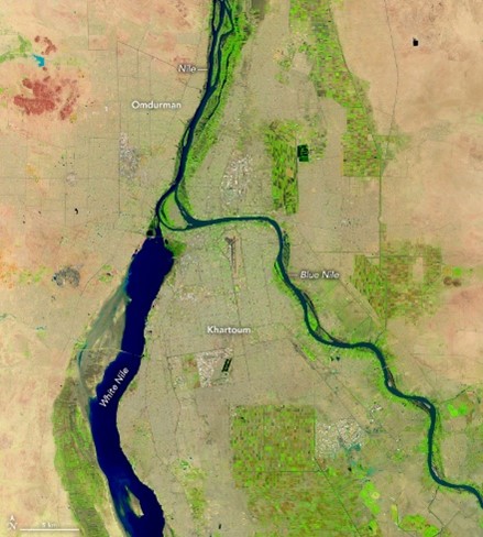
One such example the Board reviewed was a model used by Mercy Corps aimed at predicting crop yields in Sudan, a region highly vulnerable to climate variability. Through a 90-minute case review, a group of geospatial experts—from across the public and private sectors—worked together to improve the effectiveness of the model. Experts recommended several strategies and datasets, including the use of higher-resolution satellite data (e.g., Sentinel-2 and Planet) and applying a cropland mask to distinguish farmland from natural vegetation. By working with individuals from varying fields, new and innovative solutions emerge, much like the recommendations from the Earth Science Review Board.
PAX for Peace: Geospatial Data in Action in Yemen
Another example of geospatial data making a real-world impact on the climate comes from PAX for Peace, a Lifelines Humanitarian Wayfinder partner. In 2022, PAX used satellite imagery and open-source geospatial tools to uncover a series of oil spills along the coast of Yemen, caused by decaying oil tankers in the Port of Aden. These spills posed a significant threat to the environment, local fishing communities, and humanitarian efforts. Without proper intervention, the spills could further degrade ecosystems and compromise the import of critical humanitarian supplies.

PAX’s investigation not only raised awareness but also spurred action from local journalists and authorities. This collaboration between technology, local knowledge, and advocacy highlights the critical role geospatial information can play in responding to environmental disasters. By identifying pollution sources and assessing their spread, PAX was able to provide the data needed for targeted clean-up efforts, demonstrating how EO can help protect vulnerable populations and ecosystems.
Advancing SDG 13 Through Lifelines and Collaboration
Programs like the Earth Science Review Board and partnerships with organizations like PAX for Peace show the necessity of pursuing collaborative efforts. They underscore why it is essential for stakeholders representing numerous social and industry perspectives to come together. The more perspectives involved, the more likely we are to identify comprehensive solutions that help strengthen resilience to climate hazards (target 13.1), integrate climate measures into planning (13.2), and improve awareness around climate mitigation and early warning (13.3).
Many of our programs can be replicated across contexts; please get in touch if we can help set up similar processes at your organization, university, or community!
Date Published: October 28th, 2024


